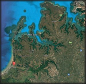
Named after a member of our family, Hunters Retreat is located about an hours drive from Darwin, Northern Territory. Situated high and dry above the Bynoe Harbour storm surge, Finniss River floodplain and billabongs. All weather, all season perfection.
Privately owned acreage currently undergoing revegetation and development. A secluded, tranquil, private piece of the Northern Territory. Located within an hours drive of Darwin. No crowds, no hustle and bustle, just the sounds of nature. An easy and convenient location to explore a one-of-a-kind unspoilt natural environment and enjoy a piece of the NT’s paradise!
Help us work towards providing an experience you too can enjoy by taking our survey.
Australia’s Northern Territory is teeming with exotic birdlife, mammals, reptiles and marine life. The Finniss River and Bynoe Harbour included. The Finniss River coastal floodplain, about 70 km south-west of Darwin is dominated by seasonally inundated grassland and sedgeland with areas of paperbark open-forest. The Finniss River floodplain is also of international significance. This site is listed as a wetland of national significance in the Directory of Important Wetlands in Australia.
The area supports very large numbers of waterbirds, including more than 1% of the world’s populations of Magpie Geese and Pied Herons, and high densities of many other waterbird species. It supports important breeding activity by Saltwater Crocodiles, Magpie Geese and other waterbirds, and three large waterbird breeding colonies are known to be located in paperbark swamps on the floodplain. Approximately five threatened birds and one threatened plant species also call this area home.
Of national importance are the vulnerable and threatened species of:
Plants – Monochoria hastate
Vertebrates – Australian Bustard Ardeotis australis, Masked Owl Tyto
novaehollandiae kimberli, Partridge Pigeon Geophaps smithii, Red Goshawk
Erythrotriorchis radiatus, and Yellow-spotted Monitor Varanus panoptes.
Cycas canalis subsp. canalis on the other hand grows prolifically only in the in the Darwin Coastal bioregion. Wallaby are also very abundant.
Less than 1000 ha of mostly dry rainforest occur in this site, especially in coastal areas near Stingray Head. Most of the rainforest occurs
as small patches (<10 ha) but one significant patch is >100 ha.
Floating grass mats of the billabongs of the Finniss and Reynolds Rivers not destroyed by buffalo, provide an important habitat refuge and source of food for a range of fauna in the dry season, especially crocodiles. There are more crocodiles in the Northern Territory than anywhere else in the world.
Although the Finniss Sub-Region is an establishing rural living area and an important recreational area for Darwin residents and visitors, careful growth and development is required to preserve the very reason it is so popular!
Important wildlife breeding sites and concentrations of rare, threatened or endangered flora and fauna species are worth protecting.
There are at least half a dozen boat ramps in the Finnis River & Bynoe Harbour area.
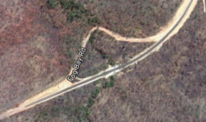
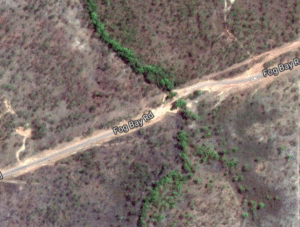
MILNE INLET – At Milne Inlet. Turn off Fog Bay Rd along Bynoe Haven Rd past Sand Palms Roadhouse and then Milne Road. Best with tides higher than 3 meters.
STINGRAY HEAD BEACH LAUNCH – Turn off Cox Peninsular Rd onto Fog Bay Road. About 55 km along Fog Bay Rd the road makes a sharp turn where the large Dundee sign is. Instead of heading to the lodge, follow the dirt track to Five Mile Beach.
DUNDEE – Turn off Cox Peninsular Road, the ramp is about 60km down Fog Bay Road. It is best to launch the boat with tides above 3 meters.
SIX PACK CREEK – At Mackenzie Arm. Turn off Fog Bay Road along Barramundi Drive. Best with tides higher than 2 meters.
At Mackenzie arm. Turn off Fog Bay Road along Dundee Road. Best with tides higher than 2 meters.
MOUTH OF ANNIES – If you are heading towards Cox Peninsular driving along Fog Bay Road there is a dirt track on the left 1.8 km past Lenny Creek. Follow the track to the end. Need a 4WD as it is necessary to drive onto sand to access launch site.
MOUTH OF FINNISS – Drive along 5 mile beach to the mouth of the Finniss. Launch boat off the beach – or – with permission from the Professional Fisherman’s Camp. Ramp is a couple of kilometers upstream continuing along a track from the mouth of the Finniss
River Road FINNIS River – Not Tidal. Take Hardcastle Road which is 500m before/after SandPalms Roadhouse on Fog Bay road then turn right about 3km along and go all the way down River road. River road and adjacent land floods in the wet season making access impossible for large periods of time. Check the NT Road Reports page and look for restriction alerts like this:
2017 Road Report Website Restrictions
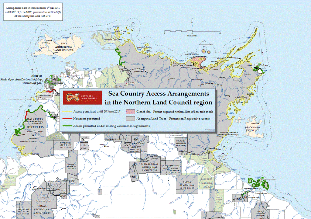
In December 2016 The Northern Land Council declared that a permit is required in relation to the areas marked in red on the Sea Country Access map. This is regardless of the six month waiver until 30 June 2017 on the requirements for a permit.
Arrangements in the Northern Land Council Region map, include:
…..(b) those parts of the Delissaville/Wagait/Larrakia Aboriginal Land Trust, more particularly described as the upper Finniss River.
Northern Land Council Sea Country Access Arrangements in the Northern Land Council region
It was supposed to be that from 1 July 2017 all commercial fishing operators and recreational fishers will require permission from Aboriginal land owners and the Northern Land Council (NLC) through the grant of a licence or permit to fish in tidal waters over Aboriginal land except in permitted access areas. But typical NT, this still doesn’t appear to be fully resolved!
Note: The Finniss River, access and fishing at River Road/Hardcastle road, has been highlighted as “No Access Permitted”. Time will tell as to whether this is fully implemented.
Crab Claw Island Resort– Private boat ramp to access the fabulous fishing. Turn off about 24 km from Cox Peninsula Rd – Fog Bay Road intersection. Dirt road – well sign posted. Great accommodation too!
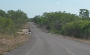
In the May 2016 NTG Budget, Transport Capital for Top End Rural and Regional was announced.
This included the completion of the Fog Bay Road upgrade at Rocky Creek Bridge and thus the final wet season obstacle addressed for Bynoe and Dundee residents and visitors.
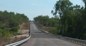
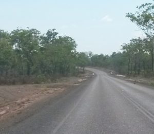
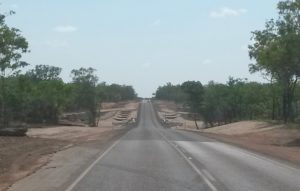
Fog Bay Road has had a number of upgrades in recent times.
Annie River BridgeCharlotte River Bridge
Changing from being totally unsealed with no bridges to the current bituminised road with now all the rivers Charlotte, Annie, Rocky and Leviathan Creek now bridged.
Leviathan Creek BridgeLeviathan Creek Bridge Fog Bay Road
The 2016-17 budget allowed for continued funding to the existing upgrading of Leviathan Creek Bridge (now complete) as well as provide new funding for the Rock Creek Bridge crossing – the last crossing to be upgraded.
A total of $5.77 million of Northern Territory Government funding had been provided for Fog Bay Road in 2016-17. About $4M alone on the Leviathan Creek Bridge.
Rocky CreekRocky Creek Bridge Fog Bay Road
Construction of Rocky Creek Bridge was done under tender awarded to Allan King & Sons Construction Pty Ltd with a tender costing of $1,570,888. This was published by the Northern Terrory Goverment at the end of Novemeber 2016.
As the 2016-17 wet season like many before had resulted in Rocky Creek being impassable due to flooding and surface conditions ruined on numerous occasions the completion of road works before the 2017-18 wet season is a welcomed sight!
Fog Bay Road is now a much better all season road for residents and tourists alike.

 Australia’s Northern Territory is teeming with exotic birdlife, mammals, reptiles and marine life. The Finniss River and Bynoe Harbour included. The Finniss River coastal floodplain, about 70 km south-west of Darwin is dominated by seasonally inundated grassland and sedgeland with areas of paperbark open-forest. The Finniss River floodplain is also of international significance. This site is listed as a wetland of national significance in the Directory of Important Wetlands in Australia.
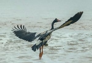 The area supports very large numbers of waterbirds, including more than 1% of the world’s populations of Magpie Geese and Pied Herons, and high densities of many other waterbird species. It supports important breeding activity by Saltwater Crocodiles, Magpie Geese and other waterbirds, and three
 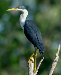 large waterbird breeding colonies are known to be located in paperbark swamps on the floodplain. Approximately five threatened birds and one threatened plant species also call this area home.
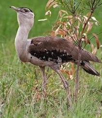 Masked Owl Tyto
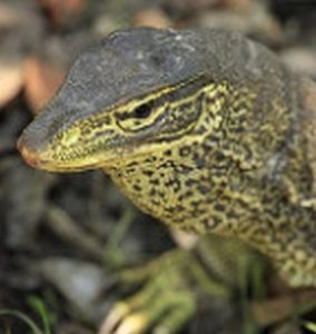
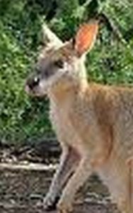 Wallaby are also very abundant.
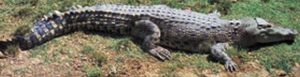 Floating grass mats of the billabongs of the Finniss and Reynolds Rivers not destroyed by buffalo, provide an important habitat refuge and source of food for a range of fauna in the dry season, especially crocodiles. There are more crocodiles in the Northern Territory than anywhere else in the world.
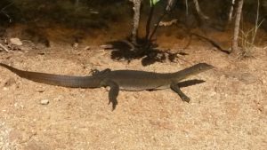
 There are at least half a dozen boat ramps in the Finnis River & Bynoe Harbour area.